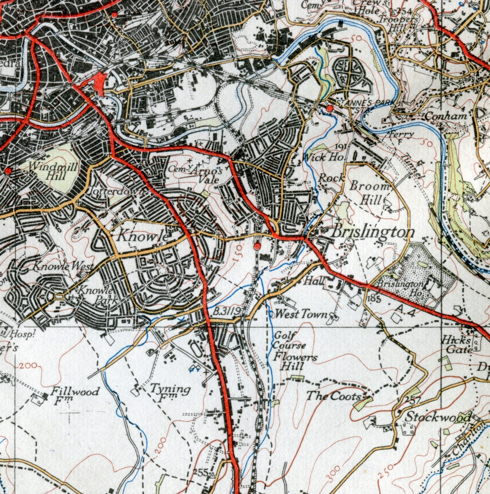
1929 map - 4th Ed OS, 1"
Click ^ for larger image.
This Ordnance Survey map shows Brislington as it was some time before 1929. Ordnance survey maps can be a bit confusing because they didn't update everything all at once, for example this map shows changes to the railways up until 1927.
This is from map 111 "Bath, Bristol and District" in the Popular Edition (often referred to as the 4th Edition of Ordnance Survey maps, at the scale of one inch to the mile (1:63360).
For higher resolution local maps of a variety of dates, visit Know Your Place. This resource is interactive and anyone can contribute photos and information.
A variety of other high resolution local maps are availabe from the National Library of Scotland (other sources are available).
Period: Modern
Exhibit contributed by Ordnance Survey
Text written by Ken Taylor (2022)
Acquisition number: 220308a1