1907 map - 3rd Ed OS, 1"
Click ^ for larger image.
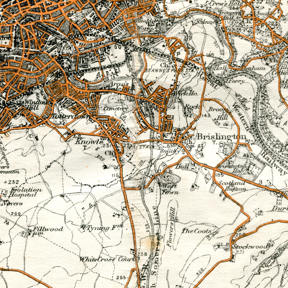
This Ordnance Survey map shows Brislington as it was some time before its publication date of 1907.
This is from map "Bristol District" in the 3rd Edition of Ordnance Survey maps, at the scale of one inch to the mile (1:63360).
For higher resolution local maps of a variety of dates, visit Know Your Place. This resource is interactive and anyone can contribute photos and information.
A variety of other high resolution local maps are availabe from the National Library of Scotland (other sources are available).
Period: Modern
Exhibit contributed by Ken Taylor
Text written by Ken Taylor (2022)
Photographer: Original map by Ordnance Survey
Acquisition number: 220929a1